Now Reading: Cyclone Ditwah Forms: Coastal States on High Alert
-
01
Cyclone Ditwah Forms: Coastal States on High Alert
Cyclone Ditwah Forms: Coastal States on High Alert

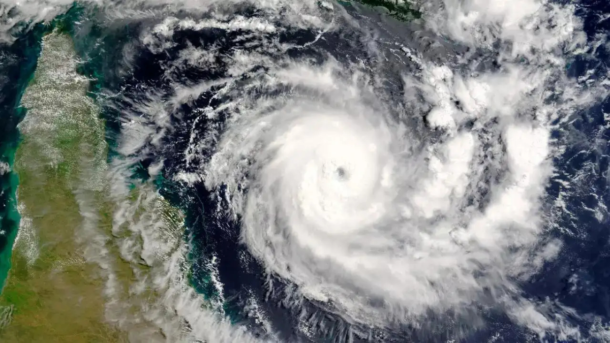
New Delhi, November 27, 2025: The Bay of Bengal has given rise to a new cyclonic storm, named Cyclone Ditwah, as confirmed by the India Meteorological Department (IMD). The storm, which quickly intensified from a deep depression, is currently tracking towards the eastern coast of India, prompting the issuance of Yellow and Orange alerts for Tamil Nadu, Puducherry, and adjoining parts of South Andhra Pradesh.
Storm’s Position and Expected Path
As of Thursday afternoon, November 27, 2025, Cyclone Ditwah was located over the southwest Bay of Bengal, lying close to the Sri Lankan coast. It was positioned approximately 700 km south-southeast of Chennai.
The IMD forecasts that the system will continue to move in a north-northwestward direction. It is expected to travel across the southwest Bay of Bengal and the adjoining Sri Lanka coast, gradually heading towards the Indian mainland. Current projections suggest that the storm will reach the waters off the North Tamil Nadu, Puducherry, and South Andhra Pradesh coasts by the early morning of November 30 (Sunday).
The storm is likely to intensify further as it approaches the coast, bringing with it the threat of heavy rain and strong winds. Its peak wind speeds are expected to be in the range of 80-90 km/hr, with gusts reaching up to 100 km/hr around November 29 and 30.
Severe Rainfall Warnings and Alerts
In preparation for the cyclone’s impact, the IMD has issued phased warnings:
- Orange Alert: This warning, indicating the potential for heavy to very heavy rainfall, has been issued for several coastal and interior districts in Tamil Nadu for November 29. These districts include Chennai, Thiruvallur, Ranipettai, Chengalpattu, Villupuram, Cuddalore, and the Delta districts like Nagapattinam and Thanjavur. A similar alert is in place for coastal districts of South Andhra Pradesh (Prakasam, Nellore, Tirupati) on November 30.
- Heavy to Extremely Heavy Rain: North Tamil Nadu is particularly vulnerable, with forecasts suggesting extremely heavy rainfall (over 204 mm in 24 hours) is likely on November 29 and 30. Kerala is also expected to receive widespread rainfall and is currently under a Yellow alert till November 29.
Preparedness and Public Safety Advisory
Authorities in the affected states have initiated full-scale precautionary measures. The Chief Minister of Tamil Nadu has urged officials to ensure a coordinated response, focusing on setting up relief centers, readying medical teams, and deploying National Disaster Response Force (NDRF) units in vulnerable areas.
Key Advisories for Residents:
- Fishermen have been strictly advised not to venture into the sea across the southwest and adjoining southeast Bay of Bengal.
- Coastal communities are urged to stay alert and continuously monitor the latest updates from the IMD and local government agencies.
- Residents in low-lying areas should prepare for possible waterlogging and localised flooding and be ready for swift evacuation if instructed by officials.
This is the third cyclonic storm in the North Indian Ocean basin this post-monsoon season, underscoring a period of high meteorological activity. The storm, named Ditwah—a name contributed by Yemen—demands continuous vigilance from all coastal administrations and residents as it continues its track toward the Indian coastline.


