Now Reading: Satellite Images Reveal Catastrophic Devastation at Texas Summer Camp Following Historic Floods
-
01
Satellite Images Reveal Catastrophic Devastation at Texas Summer Camp Following Historic Floods
Satellite Images Reveal Catastrophic Devastation at Texas Summer Camp Following Historic Floods

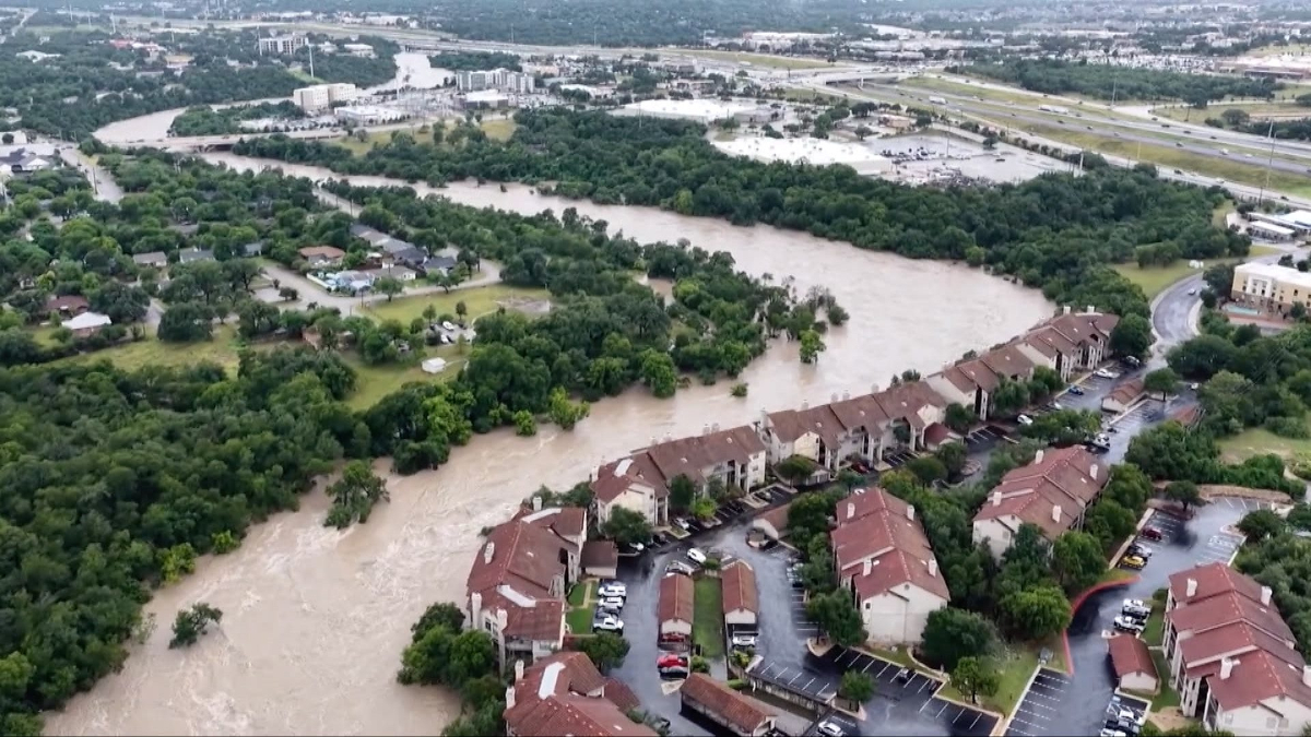
Recent satellite imagery has laid bare the catastrophic impact of the unprecedented flash floods that swept through Texas’s beloved Hill Country, particularly highlighting the extensive damage inflicted upon a historic summer camp. The aerial views show a landscape dramatically altered, with structures reduced to debris, once-lush riverbanks scoured clean, and the tell-tale signs of a powerful deluge that left little untouched.
The images underscore the sheer force of the floodwaters, which, in some areas, reportedly rose by dozens of feet in mere hours after months’ worth of rain fell in a single night. What were once idyllic scenes of cabins nestled among trees and recreational areas bustling with campers now appear as a desolate expanse of mud, twisted metal, and scattered remnants of buildings. The satellite perspective offers a chilling clarity on the scale of the disaster, revealing how entire sections of the camp were either completely washed away or severely compromised.
This devastation is particularly poignant for communities across Texas and beyond, as the affected camps, some with a century of history, have been cherished summer havens for generations of children. The loss extends far beyond physical structures, touching the memories and traditions of countless families who sent their children to experience the Texas summer.
The high-resolution imagery will undoubtedly aid in ongoing recovery and rebuilding efforts, providing crucial data for assessing damage and planning future mitigation strategies. However, for now, they serve as a stark visual testament to the destructive power of nature and the profound loss experienced by all connected to the now flood-ravaged Texas summer camps. The focus remains on the immense humanitarian effort, as search and rescue teams continue their tireless work amidst the challenging conditions, a stark reminder of the lives that have been irrevocably altered by this natural disaster.


