Now Reading: Cyclone Ditwah Weakens: Deep Depression Brings More Rain to Tamil Nadu and Andhra
-
01
Cyclone Ditwah Weakens: Deep Depression Brings More Rain to Tamil Nadu and Andhra
Cyclone Ditwah Weakens: Deep Depression Brings More Rain to Tamil Nadu and Andhra

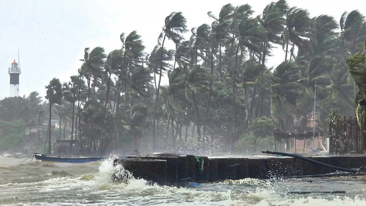
December 1, 2025 — The cyclonic storm Ditwah has weakened significantly, downgrading into a deep depression as it tracks parallel to the coasts of North Tamil Nadu and Puducherry. While the immediate threat of a severe cyclone has passed, the weather system continues to feed moisture into the region, leading the India Meteorological Department (IMD) to warn of continued heavy rainfall in several districts of Tamil Nadu and neighboring Andhra Pradesh today.
Current Status and Trajectory
As of Monday morning, the deep depression (the remnant of Cyclone Ditwah) was centered over the southwest Bay of Bengal. It is positioned approximately 90 km south-southeast of Chennai and is moving slowly in a northerly direction. The IMD forecasts that the system is likely to weaken further into a regular depression by Monday noon as it continues its path nearly parallel to the coast.
Despite losing the intensity of a cyclonic storm, the system’s proximity to the shore ensures that its impact—primarily in the form of heavy rain—will linger.
Expected Rainfall and Alerts
The focus of the heavy rainfall has shifted, and authorities are closely monitoring the situation.
- Tamil Nadu: Heavy to very heavy rain is predicted for isolated places in northern districts, including Tiruvallur, Ranipet, Kancheepuram, Chennai, Chengalpattu, and Vellore. Light to moderate rainfall is expected in most other parts of the state and the Puducherry-Karaikal area.
- Andhra Pradesh: The weather system’s moisture is also extending northward. Coastal Andhra Pradesh, particularly the Rayalaseema region, is on alert for heavy rainfall and the risk of localized flooding over the next 48 hours. Districts like Nellore and Tirupati have already begun witnessing strong winds and moderate to heavy showers.
Residents in low-lying and flood-prone areas are urged to remain extremely cautious and monitor local advisories.
Impact and Preparedness Efforts
The preceding days of heavy rain and strong winds triggered by Cyclone Ditwah have already caused significant disruption and tragic losses in Tamil Nadu:
- Fatalities: At least three rain-related deaths have been reported across the state, resulting from incidents like wall collapses and electrocution.
- Damage: Coastal areas, especially delta districts like Ramanathapuram and Nagapattinam, have reported severe waterlogging, damage to crops, and destruction of vulnerable housing.
- Safety Measures: Government authorities have deployed the National Disaster Response Force (NDRF) and State Disaster Response Force (SDRF) teams in vulnerable districts. Over 6,000 relief camps have been established to provide temporary shelter.
- Transport and Sea Travel: Sea conditions remain very rough, and a strict ban on fishing is in force along the coasts of Tamil Nadu, Puducherry, and South Andhra Pradesh until the weather improves.
As the system moves further away and continues to weaken, wind speeds are expected to gradually decrease, and sea conditions will begin to improve from Monday afternoon.
The government and disaster management teams remain on high alert, urging the public to avoid unnecessary travel and stay clear of waterlogged roads and coastlines until the weather system completely dissipates.


